
Walk the Lee County Street Directory
A sound street directory result begins with one situs address. Situs means the physical location assigned to a parcel, not the owner's mail destination. The Lee County Property Appraiser search connects it to an owner, STRAP or Folio, legal description, deed references, building facts, exemptions, and sales. Those fields establish land ownership. They do not name every person who stays there.
- Enter the number and normalized street name. Confirm Site Info, not only Owner Info.
- Open the parcel in GeoView and select adjoining lots.
- Record the STRAP, owner, mailing address, legal description, and newest deed reference.
- Follow that citation into the Clerk's Official Records search.
- Use permits, voter data, and dated reverse directories as separate occupancy evidence.
A homestead exemption may support owner occupancy, but it is not a household roster. Matching mailing and situs addresses help, yet seasonal owners, trusts, estates, and businesses can still appear on the roll.
Lee County Street Directory Search Fields
Address Source switches between the property location and the owner's correspondence address. That distinction matters throughout Lee County. Use the least text that finds the parcel, then confirm the result against the legal description and map.
| Field | Street-search use | Format clue |
|---|---|---|
| Street address | Find the physical parcel | Normalized number and name |
| Postal code | Narrow repeated street names | Search site and owner ZIP separately |
| Owner or company | Check parcels linked to a name | Last name first |
| STRAP or Folio | Identify land despite address changes | 17 digits or eight digits |
| Legal description | Search subdivision, lot, block | Useful when street text fails |
| Instrument or book/page | Reach a recorded deed | Copy from parcel card |
- Parcel
- A mapped unit of land with its own tax identifier.
- Situs address
- The physical E911 address assigned to the property.
- Plat
- A recorded map showing blocks, lots, and roads.
- Criss-cross directory
- A directory arranged by street or phone number, not only surname.
Online Reports can produce parcel, sales, and subdivision lists. STRAP and legal description stay useful when street wording changes.
Browse Street Directory Parcels in Lee County
GeoView turns one address into a block view. Zoom until parcel lines appear, then right-click a polygon, or tap and hold. Selected parcels fill a sortable table. Current and historic aerials, zoning, sales, measurements, notes, save, and print tools add context. The limit is 1,000 parcels.
The official GeoView instructions show these controls:
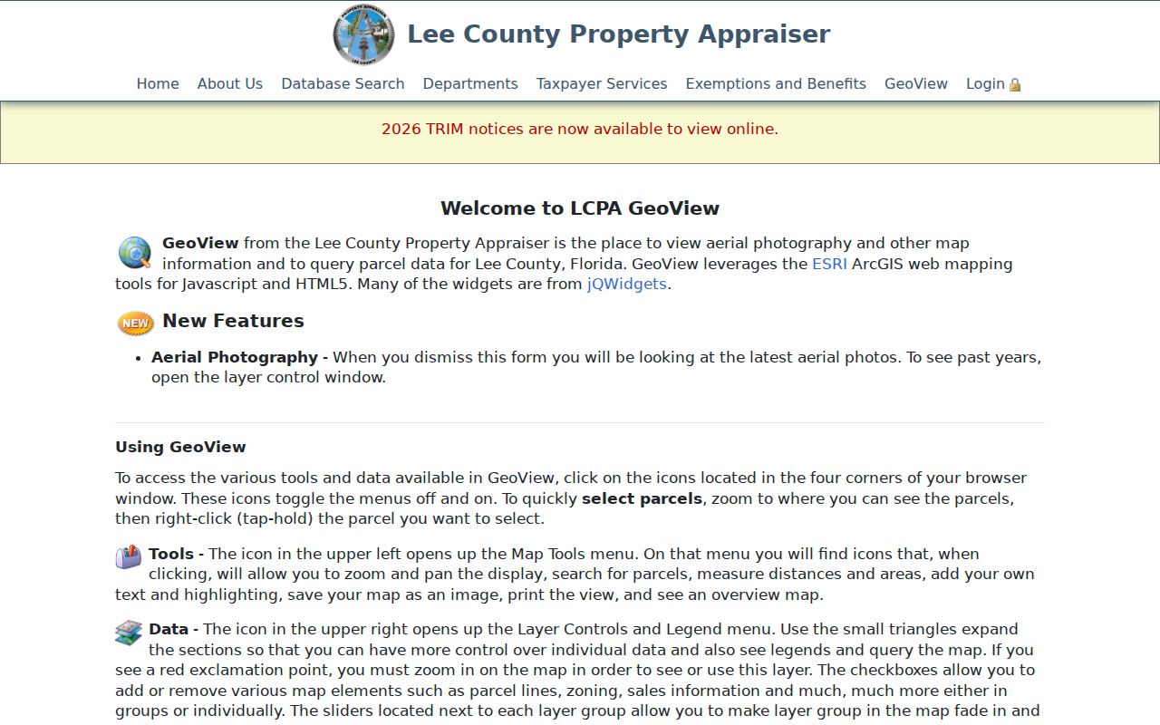
The table helps compare adjacent situs and mailing addresses. GeoView is informational, not a legal survey.
The Resident Information Tool adds municipality, districts, utilities, evacuation data, emergency services, and public facilities from an address or STRAP. It does not reveal utility customers.
Note: A Fort Myers postal address can lie in Iona, Gateway, San Carlos Park, Three Oaks, or near FGCU.
Lee County Street Directory Record Layers
No single street directory contains every address fact. Lee County splits records among offices, departments, cities, and historical collections. Dates must be compared.
| Layer | Custodian | Contribution | Access |
|---|---|---|---|
| Property roll | Property Appraiser | Owner, situs, mail, structure, deed link | Free web search |
| Parcel map | Property Appraiser / GIS | Lot order, aerials, zoning, sales | GeoView |
| Deeds and plats | Lee Clerk | Parties, transfers, legal descriptions | Web, kiosk, counter, mail |
| Voter extract | Lee Elections | Some registered voters by geography | Data order |
| Permits | County or city | Work and inspection history | Portal or request |
| Older directory | Regional Library | Dated occupants and reverse entries | Genealogy Room |
A parcel number ties the roll to deeds and often permits. Florida voting history shows participation, never ballot choice. Protected voters and nonvoters are absent, so no extract is a household list.
Access does not end at a web portal. Official Records may be viewed through a public kiosk or registered service when anonymous image access is limited. Permit files may require an in-person visit or a request to the department that created them. The library provides microfilm readers and enhanced FamilySearch access on branch computers. Under Florida Public Records Law, a requester generally need not explain a purpose or use a special form, though lawful copy and extensive-use charges can apply.
Send each request to its custodian. County administration's NextRequest center handles department records, but it does not replace the Clerk for deeds, the Property Appraiser for assessment data, or Elections for voter extracts. The county also accepts requests through its custodian at 2115 Second Street, by email at PRRCustodian@leegov.com, or by phone at 239-533-8735.
Connect the Lee County Street Directory to Deeds
Begin with the newest instrument, book/page, and legal description. A grantor transfers an interest; a grantee receives it. Index results show parties, roles, document type, date, citation, and sometimes an image. Read the image for the operative names and land description.
The index reaches 1887, but its default start is January 1, 2010. Reset it. The Clerk suggests surname plus first initial. Restricted images may be available through the second-floor kiosk at 2115 Second Street or Subscriber Service. Web prints are free; copies also come from Fort Myers and Cape Coral counters or by mail.
For a mail order, include the instrument number or book and page, indexed name, payment, and a self-addressed stamped envelope. Send it to Land Records at the Clerk's Fort Myers post-office box. At the counter, ask whether the need is an ordinary copy or a certified copy. Certification proves that the custodian produced the copy; it does not prove that every indexed fact remains current.
Older deed tip. Change the automatic 2010 date before concluding that a prior owner has no transaction.
Lee County Street Directory Voter Records
The Lee County Elections voter-data order form is the documented route for a geographic extract. Ask for the smallest useful area and describe the desired street or precinct plainly. Available products and fees vary by scope, from no-cost items to larger extracts priced as high as $75. The personal voter lookup at Lee.Vote serves a different purpose and should not be mistaken for a block roster.
Florida protects Social Security numbers and driver-license or state-ID numbers. Signatures may be viewed under the governing rules but may not be copied. Address Confidentiality Program participants and people covered by specified-person exemptions may be withheld. Monthly update timing can also create a lag after a move or new registration.
A voter address is a declared residence tied to registration. It does not prove that every household member appears, and it cannot establish the full population of a Lee County street. Compare it only with a record carrying its own date, such as the current assessment roll or a deed recording date.
Permits Along Lee County Streets
Permit custody follows jurisdiction. Unincorporated records belong with Development Services. The six municipalities keep local files. Confirm the municipality before choosing a portal.
The county's permit and code request route documents the fallback:
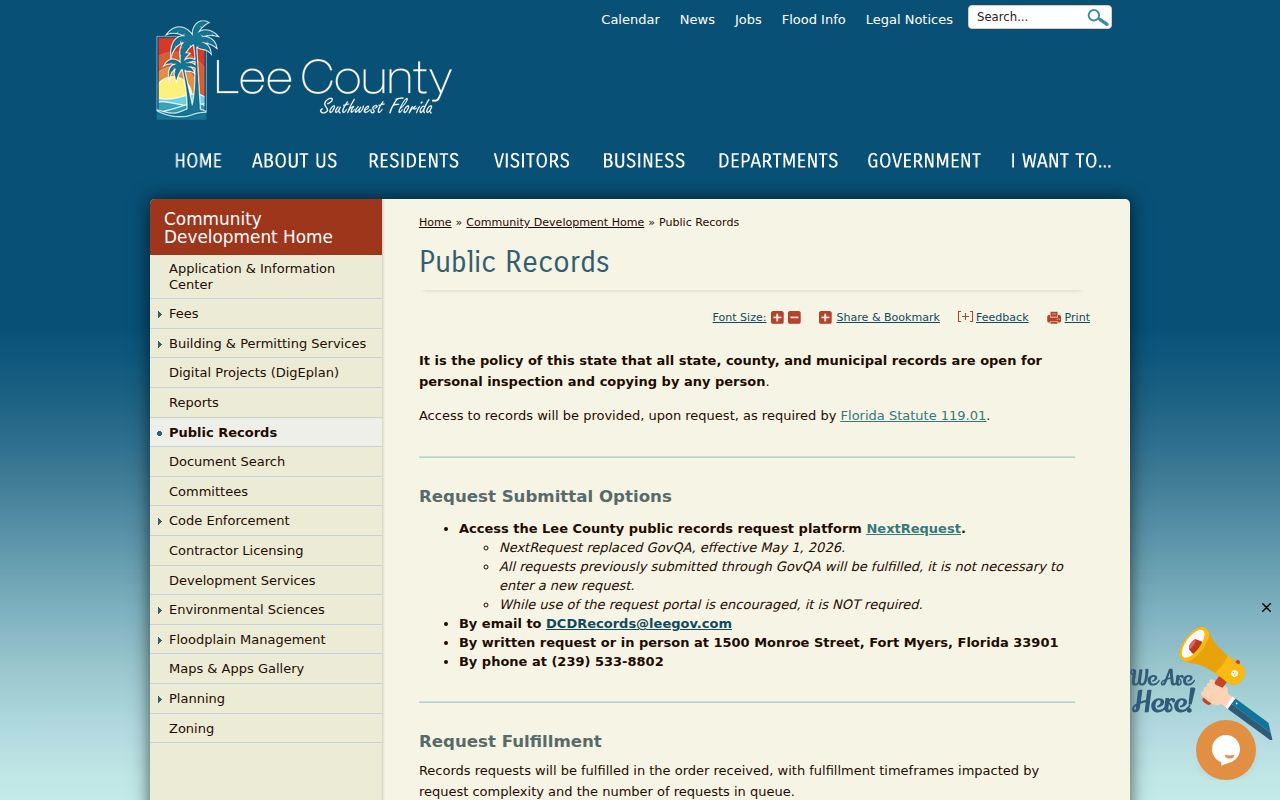
Development Services accepts requests and in-person research at 1500 Monroe Street. A permit identifies work, not all occupants.
Cape Coral's EnerGov service provides permit, inspection, invoice, map, and document functions:
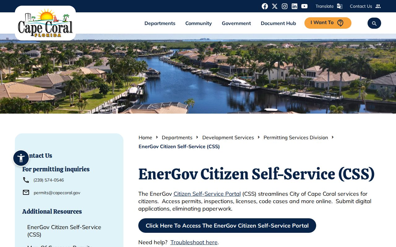
Older unscanned plans require a records request. Jurisdiction comes before portal choice.
Renamed Fort Myers Streets
An old directory can fail even when the person is correct. An FGCU oral history identifies Garret Street as Broadway and Anderson Avenue as Martin Luther King Jr. Boulevard:
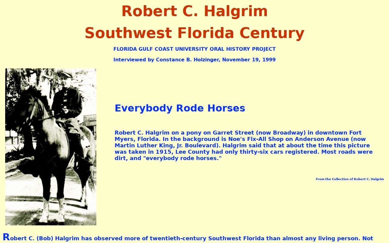
Search both forms in Polk directories, papers, deeds, and permits. If neither works, use the subdivision, lot, block, plat, and STRAP. The county E911 Addressing Office coordinates names and numbers in unincorporated Lee.
The available Fort Myers directory runs include 1915-16, 1921, 1923-27, 1935, and confirmed later issues through 1960. Reverse or street sections, where a volume contains them, can name dated occupants beside an address. Read each volume's key because abbreviations and arrangement can change. Deeds still establish ownership rather than occupancy, so a directory name should not silently replace the owner in the chain.
Fort Myers Regional Library's Genealogy Room provides affiliate access to FamilySearch images, in-library Ancestry, HeritageQuest, Fold3, newspaper microfilm, and specialist appointments. Its local newspaper run begins in 1884. Use the library genealogy service when a directory image is unavailable at home or the street form needs staff help.
Limits of Lee County Directories
A tax roll names owners, not all residents. It can omit renters, children, relatives, guests, and protected people. A deed proves a transaction, not later occupancy. A directory describes one publication year. Missing results are missing evidence, not proof.
Florida's Address Confidentiality Program and specified-person exemptions can shield locations. Driver and utility customer data are not public rosters. The Lee County street directory also cannot resolve a legal boundary dispute, because GIS is not a survey. A recorded plat may show lot geometry, but a licensed survey and the relevant recorded instruments control a property question.
Keep a small source log with the search date, roll year, recording date, directory year, and exact spelling. This prevents an old address from being presented as current. Use the city directory collections for older occupants and past residents for one parcel through time.
Lawful use. Use address records for family research, property questions, civic curiosity, and personal safety. Never stalk, harass, intimidate, or harm anyone.